

Our exploration of how to use your smartphone to become a citizen scientist continues with a look at five more research projects that are crowdsourcing important data collection and analysis to interested, smartphone-owning volunteers.
Inventorying your local wildlife
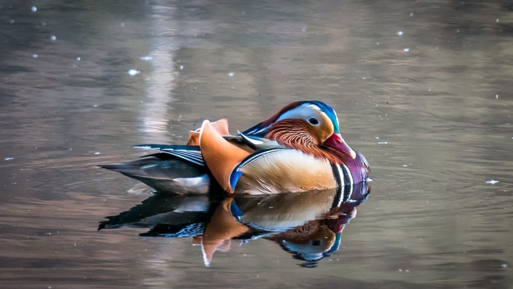
Project NOAH (Networked Organisms and Habitats) has one ambitious goal: to become the “go-to platform for documenting all the world’s organisms.” That’s the big picture, at any rate. However, for most individual users, it’s also a great way to simply learn more about the wildlife that’s right in your own backyard, wherever you live. The app has two modes. When you use the first mode, called “Spottings,” you can take photos of plants and animals that you spot, describe them, and submit the data to NOAH’s website so that population and distribution researchers, as well as other citizen scientists, can view them. If you don’t know exactly what kind of critter you spotted, you can check a box that allows other users to help you identify the species. If you choose the second mode, called “Field Missions,” you’ll be asked to provide a bit of extra help with specific studies that scientists have submitted to NOAH. For example, researchers might ask you to take photographs of invasive beetles in your area or to log your GPS coordinates when you see a flock of migrating birds pass by overhead.
Identifying trees
Visual recognition software is becoming more powerful and accurate with each year passing year, and it’s not only being used to identify faces: researchers at the University of Maryland, Columbia University, and the Smithsonian Institution are also using it to identify trees. These three entities have teamed up to create Leafsnap, a digital field guide for trees that identifies tree species based on photos of their leaves thanks to the power of visual recognition software. User-generated images are key to this project, as the more images the software has to work with, the more quickly it will learn which leaves belong to which types of trees. In addition, leaf photos uploaded to the Leafsnap app are automatically shared with scientists, who can use the data to keep track of changes in floral density and diversity. When it initially launched, Leafsnap was only usable for tree species found in Washington, DC, and New York City, although it has since expanded to include trees from the UK.
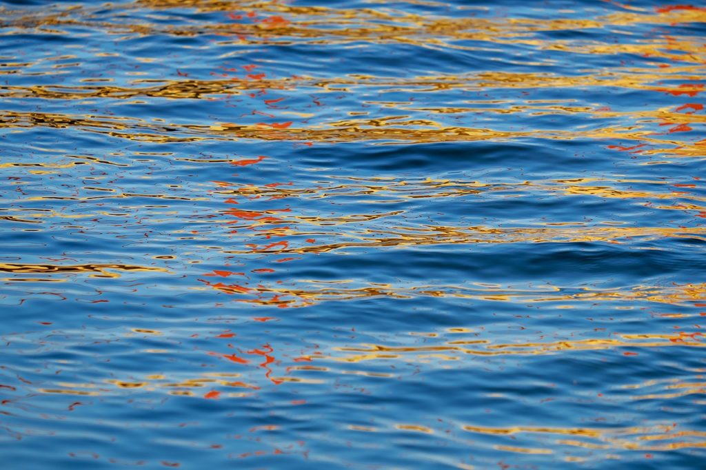
Water monitoring
In these days of erratic weather patterns and extreme weather events, water resource monitoring and management is an important concern for municipalities around the world. In order to help citizen scientists contribute to better water management in their own communities, IBM created Creek Watch, an iOS app that allows users to monitor the health of their local watershed. Whenever you pass a waterway, you can snap a photo of it and record three additional observations: the amount of water (whether the watershed is empty, partially full, or full); the rate of flow (whether the water is moving quickly, slowly, or not at all); and the amount of trash in the waterway (none, some, or a lot). IBM then aggregates the data and shares it with local water control boards so that they can better track and mitigate water pollution and manage water resources.
Helping redwoods to survive and thrive
Although most of the redwoods on the planet have been around for centuries, climate change and other environmental factors mean they could be facing a very uncertain future. Their ongoing survival may depend on a better and deeper understanding of the conditions that suit them best, which is where citizen scientists come in. Thanks to the Redwood Watch app—created by the Save the Redwoods League, Google Earth Outreach, iNaturalist.org, and the California Academy of Sciences—all you have to do to help the redwoods to survive and thrive in the future is take a picture whenever you see one, whether that’s in a national park, botanical garden, or your own backyard. The app will automatically send your photo and geographic coordinates to researchers, who can then better assess which environments are healthiest and most productive for the redwoods, and thus more effectively focus their ongoing conservation efforts.
Reporting unwanted invaders
Invasive plant and animal species can be hugely disruptive to natural ecosystems: crowding out native species, competing for food and resources, and sometimes completely overpowering local populations. Unfortunately, these species aren’t always spotted until they’ve already taken hold in significant numbers, making it difficult to eradicate them before too much damage is done. Citizen scientists can help by using the What’s Invasive app—created by researchers and programmers from UCLA, the University of Georgia, and the Santa Monica Mountains National Recreation Area—to look up lists of common invasive species in their area and submit a geo-tagged photo or observation to What’s Invasive scientists. Depending on the amount and type of data coming in, scientists will be better able to locate, identify, and attempt to remove the invasive species in question.